The story of Arbel Synagogue
The synagogue stood at the centre of the Jewish village of Arbel, on a slope below the Arbel cliffs west of the Sea of Galilee, beside today's Moshav Arbel. Unlike the black basalt houses around it, it was built of pale limestone ashlar. Most writers date it to the fourth century CE; an older proposal of the third century is no longer accepted, and the date is still debated. Coins suggest that its carved one-piece east doorway was set in place around the end of the fourth or start of the fifth century.
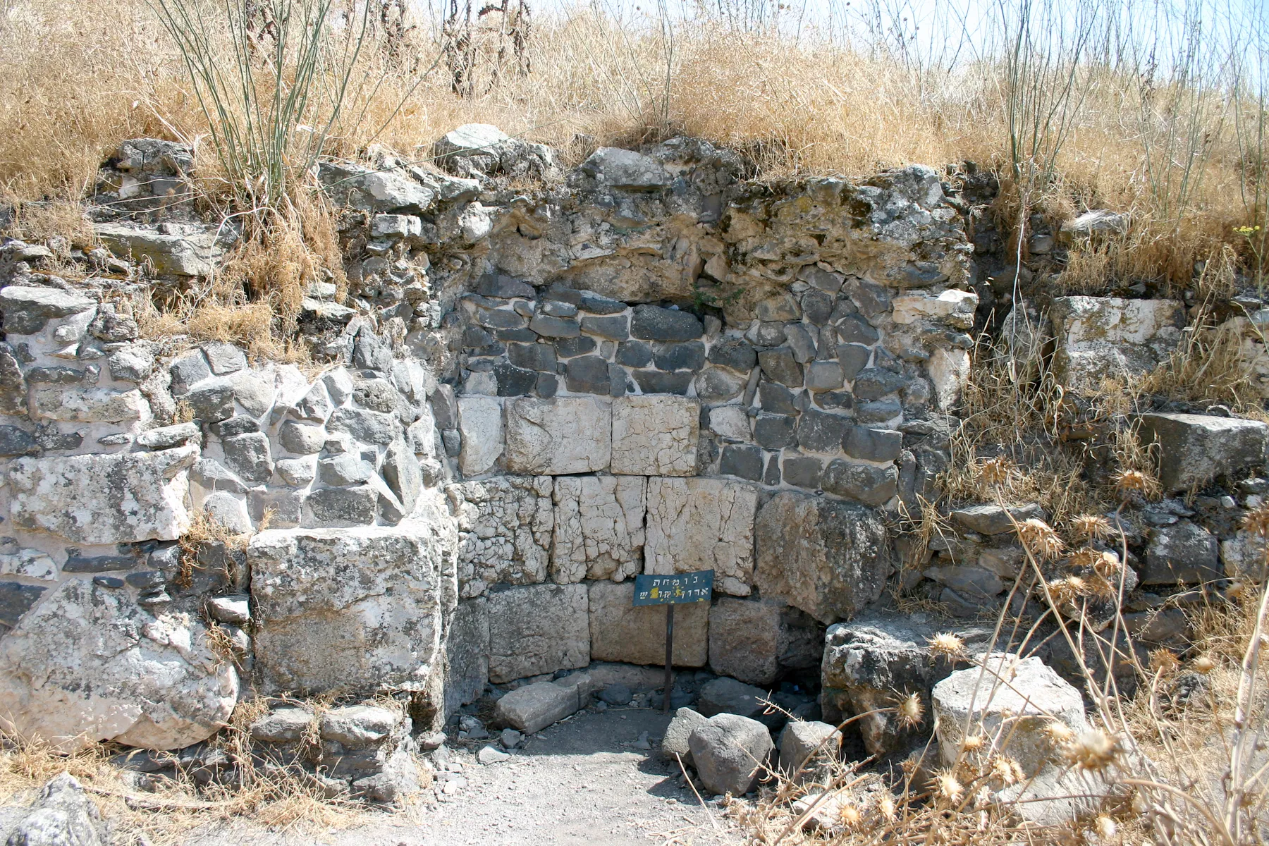
The hall measured about 20.3 by 18.5 metres, with columns on three sides in a U shape carrying an upper gallery, and benches stepping down to a floor 1.5 metres below the east threshold. Probably towards the end of the sixth century the building was remodelled: a rounded niche for the Torah ark was cut into the south wall facing Jerusalem, a reading platform was added before it and a new door opened in the north wall.
The synagogue was probably destroyed by fire in the mid-eighth century, possibly in the earthquake of 749 CE. Medieval Jewish travellers saw its ruins and its great gate. It was described by Edward Robinson in 1852, excavated by Heinrich Kohl and Carl Watzinger in 1905, and partly restored for visitors in 1987 to 1990.
Where it stood for roughly 350 to 450 years
Historic: centre of the ancient village of Arbel (Khirbet Irbid), Lower Galilee. Today: western edge of Moshav Arbel, about 2 km from the Arbel cliffs, west of Tiberias and the Sea of Galilee; pin approximate, at the site signage.
Open larger map →The Jewish community
Arbel appears in the sources long before the synagogue. The Encyclopaedia Judaica connects the place with Beth-arbel in Hosea and with the caves where Bacchides killed the inhabitants in the Maccabean wars and where Herod fought rebels in 39 BCE. Coins found in the area show the village inhabited from the Hasmonean period. The early Pharisaic sage Nittai the Arbelite is traditionally linked with it. After the destruction of the Second Temple, priests of the House of Jeshua, one of the 24 priestly courses, settled at Arbel. Rabbinic texts praise the fertility of the Arbel valley and the linen made there. The Israel Nature and Parks Authority describes Talmudic-period Arbel as a wealthy village with a magnificent synagogue, and the village was at its height in the late Roman and early Byzantine periods. Remains of the Second Temple period found beneath the synagogue may point to an earlier building on the same spot. The number of inhabitants, the community's leaders and its rabbis are unknown; no dedicatory inscription naming donors has been reported.
Architecture and design
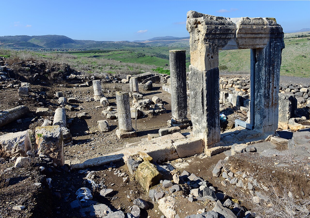
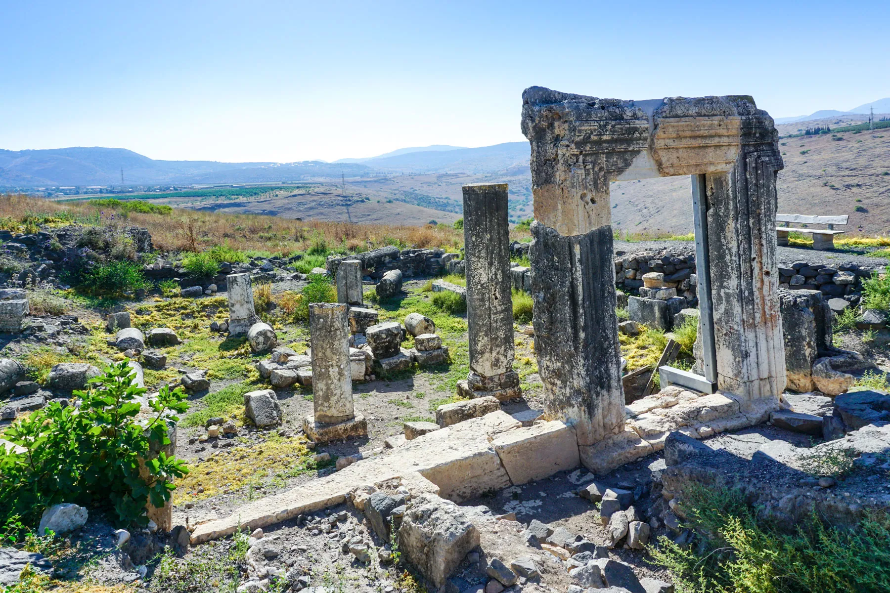
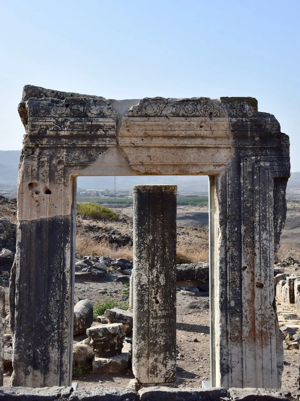
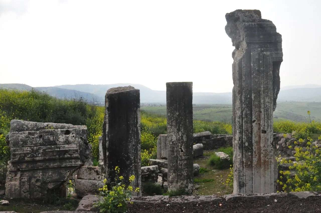
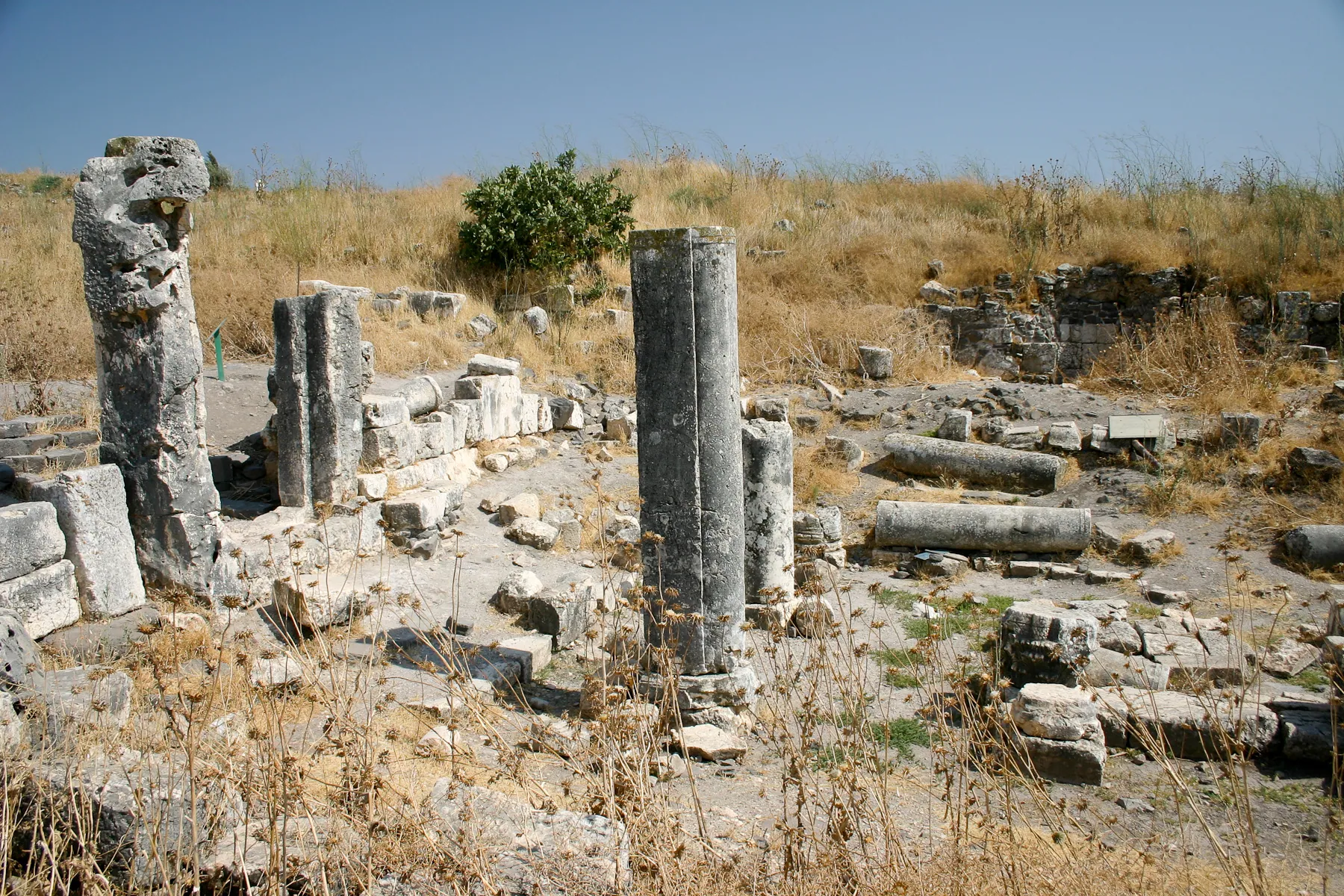
The building measures about 20.3 metres north to south and 18.5 to 18.65 metres east to west. It was built mainly of limestone ashlar, and a barrel vault under its northern part levelled the floor on the sloping ground. Three rows of columns stood in a U shape; the two pillars at the north corners have a heart-shaped section. The columns of the main hall had Corinthian capitals and narrower columns with Ionic capitals carried an upper gallery. Benches lined the east, west and north walls and also served as steps down to the hall floor. The main entrance, unusually for a Galilean synagogue, was in the east wall: its opening, threshold, jambs and lintel are carved from a single block of limestone, decorated with floral motifs and medallions, with a groove for a mezuzah. A forecourt lay in front of it. In the sixth-century remodelling a rounded ark niche was built into the south wall, a platform placed before it and a north door added. Some scholars have read the niche as a later mosque mihrab, while Nahman Avigad argued that it belonged to the synagogue. The original building may have been about five metres longer.
Life inside the synagogue
No inscription, record or literary text describing services in this building has been found, so the life of the congregation is known only from the building itself. Worshippers entered from a forecourt through the monumental east doorway and stood on a threshold about 1.5 metres above the hall floor; the stepped benches along three walls led down to it and gave seating facing the centre of the room. The upper gallery carried on the second row of columns added further space. A groove in the doorway jamb shows where a mezuzah was fixed. A small stone with a receptacle in a rear corner has been described by guides as a box for anonymous charity, though no excavation report confirming this was read. In the late sixth century the arrangement changed: the Torah ark was given a fixed place in the new niche in the south wall, oriented towards Jerusalem, and a raised platform in front of it was used for reading the Torah. Who led the congregation, what language it prayed in and how large it was are unknown.
Destruction
No source names a human agent in the end of the synagogue. Its building history had at least two phases: the Israel Nature and Parks Authority and other sources describe a substantial remodelling, or rebuilding, probably at the end of the sixth century, and an archaeoseismic catalogue notes that the building may have been damaged or destroyed in the sixth century and again in the eighth. The final destruction is placed in the mid-eighth century. The park authority's brochure, followed by several later accounts, says the synagogue was destroyed by fire, probably in connection with the great earthquake of 749 CE that also struck Beit She'an, Sepphoris and Hippos; the catalogue points out that the details of collapse are not documented and that the earthquake link is a suggestion. After the destruction the building lay in ruins. A visitor in 1211 described a ruined synagogue at Arbel. The site was later fortified in the eighteenth century by the Galilean ruler Zahir al-Umar, according to the site signage. Fallen walls, columns and capitals were left where they lay until the twentieth-century excavations and restoration.
The community’s fate
The Jewish village of Arbel declined after the destruction of the synagogue. One account says it flourished until the Muslim conquest of the seventh century; how long Jews continued to live there afterwards is unknown. By the Middle Ages the settlement had moved to the site called Khirbet Irbid, and the name survived in Arabic as Irbid or Irbil. The Persian traveller Nasir Khusraw passed 'Irbil' in 1047, and the Jewish traveller Ishtori Haparchi identified ancient Arbel with the Arab village there in 1322. Settlement seems to have declined after the Crusader period; the Ottoman tax register of 1596 records only two Muslim households, and the Survey of Western Palestine in 1881 found important ruins and traces of an Arab village. In 1949, after the 1948 war, the Israeli Moshav Arbel was founded beside the ruins. No direct descendants of the ancient community are recorded.
The site today
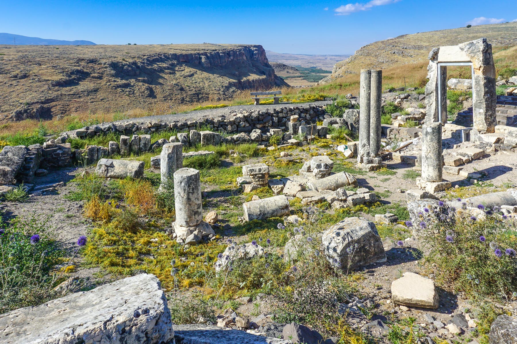
The ruin lies on the western edge of Moshav Arbel, outside Arbel National Park, and is open to visitors without charge. What stands today is a partial restoration. Zvi Ilan and Avraham Izdarechet cleared and restored the site in 1987 to 1989, and the east doorway was re-erected in 1990; about three quarters of its original stone frame survive. Several column shafts, the heart-shaped corner pillars, the stepped benches and the stone-built ark niche in the south wall can be seen, with walls standing only a few courses high; no source read gives the preserved wall height. Some scholars think the doorway was moved in antiquity or in the restoration. The Hebrew University began a new survey and excavation in 2012. A memorial overlook stands near the ruin.
Do you have something to contribute?
Photographs, documents, family stories or memories of this synagogue and its community help keep its history alive.
- Arbel National Park (Hebrew site brochure, 2025)
- Arbel (Encyclopaedia Judaica entry)
- Arbel - archaeoseismic site entry
- Arbel Ancient Synagogue
- Arbel (Ancient synagogue and ancient village sections)
- Mount Arbel
- The Ancient Synagogue of Arbel: Calamity and Charity
- Arbel Ancient Synagogue (marker)
- Arbel Synagogue
- Arbel Synagogue photo set
Share a memory or thought
No comments yet. Be the first to add one.