La storia di Modi'in Synagogue (Umm el-Umdan)
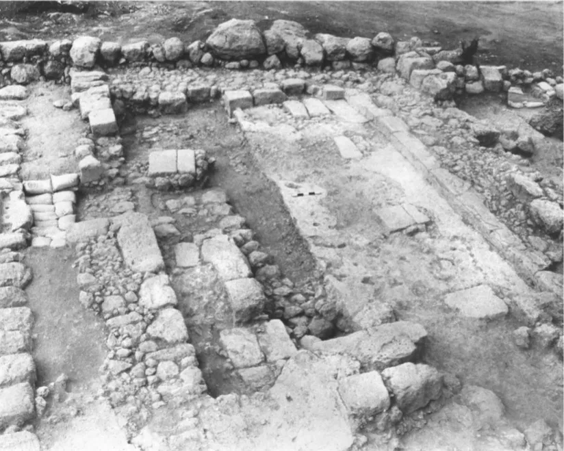
Khirbet Umm el-Umdan, 'mother of columns' in Arabic, is a ruined Jewish village of the Second Temple period inside the modern city of Modi'in. Alexander Onn and Shlomit Weksler-Bdolah excavated it for the Israel Antiquities Authority between 2000 and 2003, ahead of housing construction, and found a public building rebuilt several times on the same spot. The earliest, a small hall of the late third or early second century BCE, is of uncertain use. In the Hasmonean period, late in the second century BCE, it was replaced by a larger hall with benches along three walls and painted plaster, which the excavators identify as a synagogue; it is often described as the oldest synagogue found in the country. A further rebuilding in the second half of the first century BCE added two rows of four columns, and a ritual bath was cut beside it in the first century CE.
The excavators found ash layers in the hall and collapsed buildings around it, and connect this destruction with the Roman army of Cestius Gallus, which passed on its way to Jerusalem at the end of 66 CE. The hall was cleared and given a new floor, and the village lived on at least until the Bar Kokhba revolt of 132-135 CE. Nothing was built there after the second century until Byzantine times. The excavators suggest that the village was ancient Modi'in, home of the Hasmoneans, though other sites have also been proposed.
Where it stood
Khirbet Umm el-Umdan archaeological site, north of Sderot HaHashmonaim at the edge of the HaShvatim (Buchman) neighbourhood, reached from Reuven Street, Modi'in-Maccabim-Re'ut, Central District, Israel. Approximate: the pin marks the mapped archaeological site, inside which the synagogue lies.
Apri la mappa grande →La comunità ebraica
Nothing written survives from the village, so its people are known only from what they left in the ground. The settlement covered about six acres, with buildings set along lanes, and two burial grounds lay 100 to 200 metres to the south and east. Seleucid coins of Antiochus III and Antiochus IV show that the place was lived in before the Hasmonean revolt. Its Jewish character appears in the ritual bath beside the public hall and in the coins of both revolts against Rome found on the site. Stone seals found near the ritual bath, one with a four-letter Aramaic inscription that Joseph Naveh read as 'vinegar' and another showing grapes, point to wine production. The excavators proposed that this was the village of Modi'in, home of the Hasmonean family, and that the Arabic name may preserve the ancient one. Other scholars place Modi'in at Tell er-Ras, Khirbet el-Hammam or Giv'at Tittora, and the question is not settled. The number of inhabitants and the name of any one of them are unknown.
Architettura e design
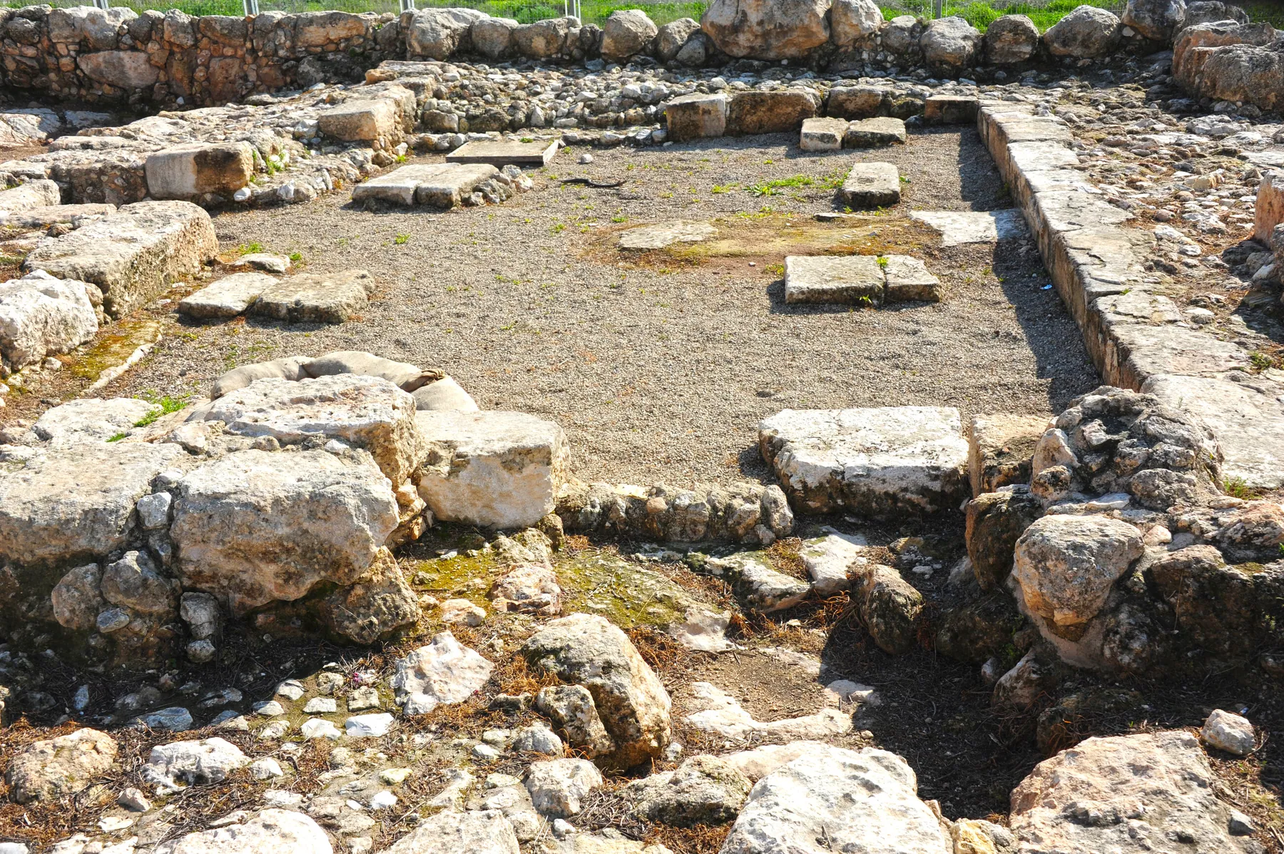
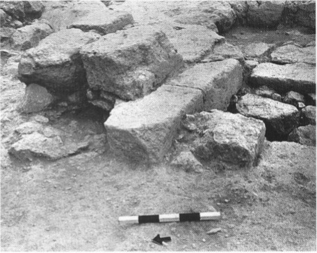
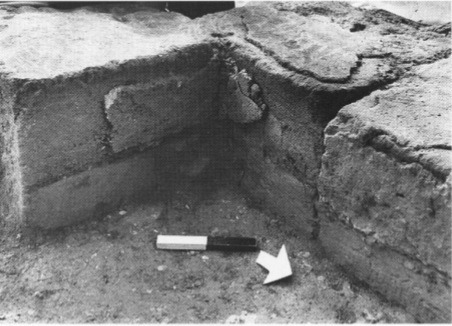
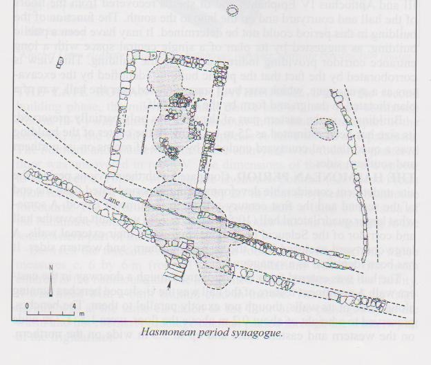
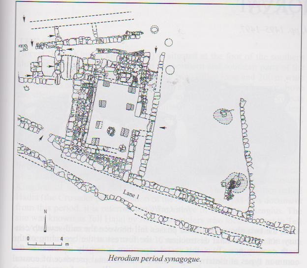
The first of three successive buildings, of the late third or early second century BCE, was a rectangular hall of 7 by 3.8 metres in a walled courtyard, entered from the west. The Hasmonean hall that replaced it measured about 10.5 to 11.5 by 6.7 metres, with a courtyard on three sides and its door in the east wall. Its walls were of large trimmed stones and carried plaster painted red, yellow and white; the floor was of ground white limestone with a fieldstone pavement in the centre, and benches ran in a U along three walls. In the second half of the first century BCE the hall was extended eastward to about 8.6 metres. Two rows of four columns now divided it, two or three stepped benches 1.7 metres wide lined the sides, the main door stood in the middle of the east wall and a second opened to the north. The floor was of crushed chalk, later replastered. The excavators compare the hall with the synagogues of Masada, Herodium, Gamla and Qiryat Sefer. A ritual bath of two rock-cut rooms lined with grey plaster was added to the west in the first half of the first century CE.
La vita nella sinagoga
No inscription or text records what took place in the hall, so its use is inferred from its plan. In both the Hasmonean and the Herodian building the benches ran along the walls, so that those seated faced the middle of the room. In the centre of the Hasmonean floor the excavators found a square installation of 1.1 by 1.1 metres raised about ten centimetres, which they call a bema, with a round base one metre across to its south; what stood on them is unknown. In the Herodian hall the middle of the northern bench was two tiers high, and the excavators suggest that it was a seat of honour. A small bathing tub stood in the Hasmonean courtyard, and the ritual bath cut beside the hall in the first century CE allowed immersion close to the building. The encyclopedia entry by the excavators mentions no Torah shrine, niche or carving with Jewish symbols. Who led the congregation, and how many people the benches held, is unknown.
Distruzione
The excavators found signs of a violent destruction: ash layers in the synagogue and the collapse of adjoining buildings, with coins of the second and third years of the First Jewish Revolt in the debris. A coin of Nero of 68 CE lay in the new plaster floor that sealed the destruction level in the hall. They link the destruction to the campaign of Cestius Gallus, whose Roman army passed the village on its march to Jerusalem at the end of 66 CE. The hall was then cleared, a new plaster floor was laid in haste, the northern door was blocked and another opened at the north end of the east wall. How the repaired building finally went out of use is not recorded. A coin of the second year of the Bar Kokhba revolt (133 CE) was found near the ritual bath, and nothing was built in the village after the second century CE. It is often said that the synagogue was destroyed in the Bar Kokhba revolt, but the excavators' encyclopedia entry does not say so and names no destroyer. Later, Late Islamic graves and a lime kiln dug into the ruins did considerable damage.
Il destino della comunità
The villagers appear to have come back after the destruction of about 66 CE: the excavators think the hasty repairs to the synagogue were made by returning residents, probably during the First Revolt itself. The ritual bath beside the hall stayed in use with minor changes, and a coin of the second year of the Bar Kokhba revolt (133 CE) found near it shows that people were still there then. Coins of Domitian and Marcus Aurelius came from another building. The excavators conclude that the village was occupied at least until the Second Revolt and that nothing was built inside it after the second century CE. Whether its people were killed, enslaved or driven out when Rome put down that revolt, or left gradually, is unknown; no source read describes their end. The site was resettled only in the Byzantine and Early Islamic periods, between the sixth and tenth centuries, when new buildings and farm installations were laid over the remains of the Jewish village. Who those later inhabitants were is not stated.
Il luogo oggi
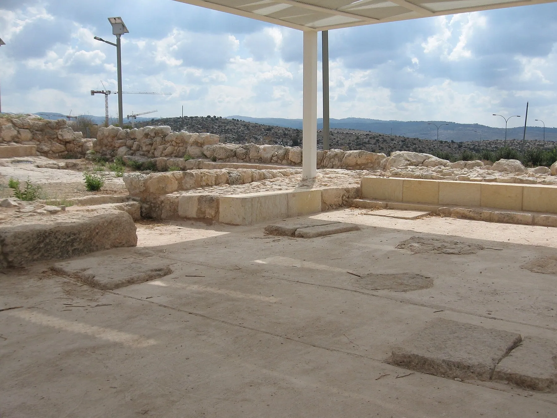
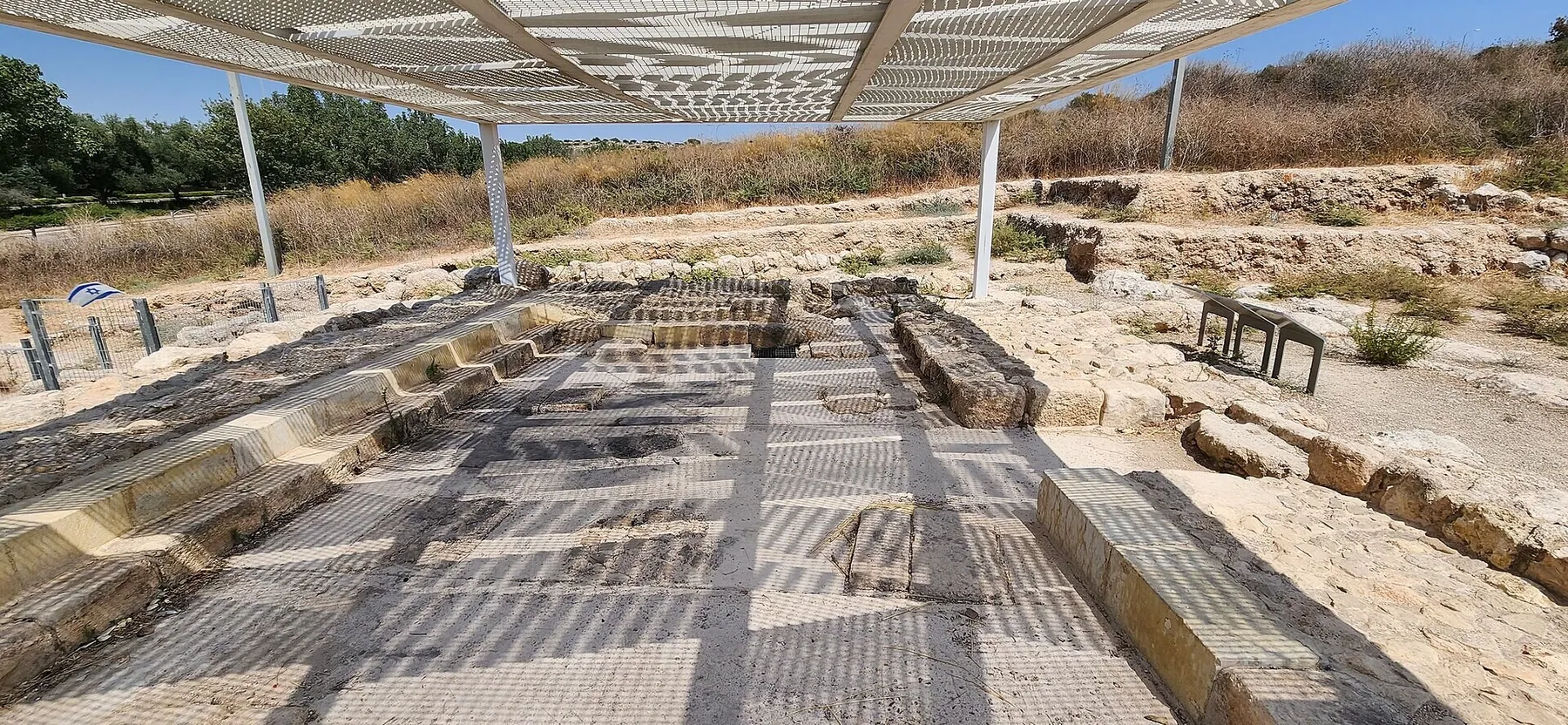
The ruins lie on the northern side of Sderot HaHashmonaim, at the edge of the HaShvatim (Buchman) neighbourhood of Modi'in-Maccabim-Re'ut, and are open to the public. Between 2012 and 2014 the site was prepared for visitors, with parking, an access road from Reuven Street and a path that runs past the ancient houses and a winepress to the synagogue and the ritual bath; the work was reported in 2013 as part of the Prime Minister's heritage programme, with a projected budget of 2.1 million shekels. Photographs show the hall as an outline of low walls with the lowest tier of its benches, a patched floor and the stone blocks on which the columns stood, under a white shade canopy; no column stands. The excavators record that the Hasmonean benches survive only about 20 centimetres above the floor.
Hai qualcosa da condividere?
Fotografie, documenti, storie di famiglia o ricordi di questa sinagoga e della sua comunità aiutano a mantenerne viva la storia.
- Umm el-'Umdan, Khirbet (Modi'in), in The New Encyclopedia of Archaeological Excavations in the Holy Land, vol. 5 (2008), pp. 2061-2063
- Umm el-Umdan
- Umm el-Umdan
- אום אל עומדן (Umm el-Umdan)
- Hanukkah: Modiin struggles to preserve its ancient Maccabean history (22 November 2013)
- File:בית הכנסת באום על עומדאן.jpg
- File:118277 antiquities site umm al-amatan - modiin PikiWiki Israel.jpg
- אום אל עומדן, archaeological site (OpenStreetMap way 812611051)
Share a memory or thought
No comments yet. Be the first to add one.