

The story of Nabratein Synagogue
Nabratein, known in rabbinic sources as Kefar Neburaya, was a Jewish village on a hill about four kilometres north of Safed in the Upper Galilee, above the southern bank of Nahal Dalton. Its synagogue was surveyed by the Palestine Exploration Fund in the 1870s, examined by Heinrich Kohl and Carl Watzinger in 1905, and excavated by Eric and Carol Meyers in 1980 and 1981.
The excavators distinguished three buildings on one spot. A small broadhouse hall of the second or third century was enlarged in the later third century. That hall was damaged around 306 CE and, the Meyers argue, ended between 350 and 363 through the revolt against Caesar Gallus, economic decline and the great earthquake of 363. After a long gap a larger basilica was built in 564 CE, a date carved on its lintel. It is thought to have remained in use into the seventh and perhaps the eighth century. Jodi Magness has disputed this sequence and argues for a single synagogue built no earlier than the late fourth century.
In 1981 the Meyers found part of a stone Torah ark pediment carved with lions and a shell. When the Survey of Western Palestine recorded the site, the building had been levelled to the ground. Why the last synagogue went out of use is unknown.
Where it stood for roughly 350 to 670 years
Historic: Kefar Neburaya, Upper Galilee. Today: Nabratein (Naburiya) archaeological site in the Biriya forest about 4 km north of Safed, above Nahal Dalton, on a forest road (approximate).
Open larger map →The Jewish community
Nabratein was a Jewish village in the Galilee in the Roman and Byzantine periods, and it appears in rabbinic literature as Kefar Neburaya. Tradition holds that the Mishnaic sage Rabbi Eleazar ha-Moda'i and Jacob of Kefar Neburaya, a figure known from rabbinic literature, are buried there; these are traditions, not findings tied to the synagogue. Archaeology shows a settlement with a synagogue from about the second century CE, a cistern with an underground hideaway that has been linked to the Bar Kokhba revolt or the Gallus revolt, and an olive crushing stone of the Byzantine period beside the synagogue. According to the excavators the village was virtually abandoned after the 360s and resettled when the synagogue was rebuilt in 564. The size of the population, its leaders and its later history are unknown. Only two members of the sixth-century congregation are known by name, from the dedicatory lintel inscription.
Architecture and design
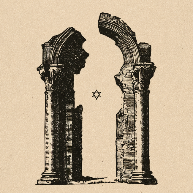
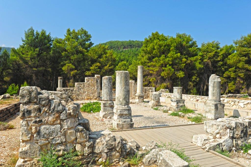
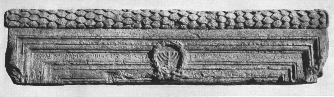
The excavators and BibleWalks give three plans. The first hall measured about 9.35 by 11.20 metres, a broadhouse according to the Meyers. It was enlarged to about 13.85 by 11.20 metres, with a stylobate added at the entrance at the end of the third century. The last building, of 564, was a basilica of about 16.90 by 11.60 metres with two rows of four columns, benches along three sides and entrances on the south and north. It faced south towards Jerusalem. The Survey of Western Palestine instead counted ten columns, five on each side, which had lost their Corinthian capitals, and a hare was roughly carved on one column base. The main lintel, about nine feet long, has mouldings, a leaf wreath along the top and a seven-branched menorah in high relief at the centre that divides a single-line Hebrew inscription. The excavated stone pediment of a Torah ark shows two lions flanking a gabled roof with a scallop shell. The architect and seating capacity are unknown.
Life inside the synagogue
Little is recorded about worship in the building beyond what the remains show. The halls had stone benches along their walls, and in the later phases a raised platform (bema) carried the Torah shrine. The pale limestone pediment found in 1981 buried in this platform weighs about half a ton and shows two lions on either side of a gabled roof with a scallop shell; Duke University has dated it to between 250 and 360 CE, and the excavators reported it as the oldest remnant of a Torah ark found in the region. The lintel over the main door names two donors, Hanina son of Lizar and Luliana son of Yudan, and dates the building to 494 years after the destruction of the Temple, that is 564 CE. The seven-branched menorah carved at its centre was later copied over the door of the Henry S. Frank Memorial Synagogue in Philadelphia. The names of rabbis or office-holders are unknown.
Destruction
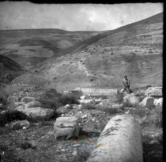
The sources read describe the ruin of the building in stages, all attributed to natural and political causes rather than to any named people. Meyers and colleagues linked the end of the first enlarged hall to an earthquake around 306 CE, after which it was rebuilt. They attribute the end of that second hall to a combination of factors: the Jewish revolt against Caesar Gallus in 350-352, economic hardship and the great earthquake of 363. The site was then virtually abandoned for two centuries. Magness disputes this reading and argues that there was only one synagogue, built no earlier than the second half of the fourth century. The basilica of 564 is said to have remained in use into the seventh and possibly the eighth century, but no source read records how or when it was destroyed. An earlier lead attributed its end to the earthquake of 749, but no source read supports this. By 1877 the building had collapsed, its columns and lintel lying on the ground.
The community’s fate
No historical record describes the end of the Jewish community of Nabratein. According to the excavators, the village was largely deserted after the troubles and earthquake of the 350s and 360s, and was resettled when the synagogue was rebuilt in 564 CE. Pottery and coins from the site led them to place the last phase of occupation in the Byzantine and early Arab periods, ending around 700 CE according to a summary of their phasing, or in the seventh or possibly eighth century according to another summary of their work. Why the inhabitants left is unknown. Neither invasion nor persecution is recorded for the site, and the sources read do not say whether the later Jewish settlement at Safed had any connection with the people of Nabratein. When the Palestine Exploration Fund surveyed the area in the 1870s, the site was a deserted ruin known in Arabic as Khirbet en-Nabratein.
The site today
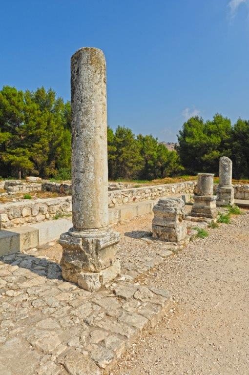
The excavated synagogue lies in a pine forest of the Jewish National Fund on a hill north of Safed and is open to the public, reached by a forest road from Highway 89 or Highway 90. The Jewish National Fund and the Israel Antiquities Authority have partly reconstructed the southern façade in reassembled ashlar masonry, and several columns have been set back up on their bases. The benches, the entrance stylobate, paving and low walls of the excavated phases are visible, together with a cistern and an olive crushing stone nearby. The height of the original walls still standing is not given in the sources read. The inscribed lintel is in the Israel Museum in Jerusalem; where the ark pediment is now kept is unknown.
Notable names
Hanina son of Lizar
6th century CEDonor named on the lintel of the synagogue of 564 CEHanina son of Lizar is one of the two men named in the Hebrew inscription carved on the main lintel of the Nabratein synagogue, which dates the building to 494 years after the destruction of the Temple, that is 564 CE. He is generally understood as one of those who built or paid for the rebuilt basilica. Nothing else is known about him.
Biography or source →Luliana son of Yudan
6th century CEDonor named on the lintel of the synagogue of 564 CELuliana son of Yudan is named alongside Hanina son of Lizar in the single-line Hebrew inscription on the lintel over the main door, which is divided by a carved seven-branched menorah and dates the rebuilding of the synagogue to 564 CE. He is known only from this inscription, now in the Israel Museum.
Biography or source →Do you have something to contribute?
Photographs, documents, family stories or memories of this synagogue and its community help keep its history alive.
- Nabratein synagogue
- Naburiya (Nabratein)
- Nabratein
- Nabratein (Earthquake Catalog of the Dead Sea Transform, archaeoseismic sites)
- Nabratein synagogue (building 167)
- Old Ark of the Covenant found in upper Galilee (4 August 1981)
- Raiders of the Lost Ark (Down Home)
- Finders of a Real Lost Ark
- Excavations at Ancient Nabratein: Synagogue and Environs (2009)
- The Survey of Western Palestine, vol. 1, p. 243
Share a memory or thought
No comments yet. Be the first to add one.